Unit - 1
Compass and Levelling
Q1) Define surveying and importance of surveying.
A1) Surveying is the art of determining the relative positions of different objects on the surface of the earth.
Importance of Surveying:
Q2) Give the principles of surveying in detail and also explain objective of surveying.
A2) There are two aspects:
1. Location of a point by measurement from two points of reference
2.Work from whole to part:
Objective of Surveying:
Q3) Explain fundamental classification of surveying and concept of scale.
A3) Plane Surveying:
Geodetic surveying:
Concept of Scale:
The ratio by which actual length of the object is reduced or increased is known as scale.
Types of scale:
1. Full size scale:
2. Reducing scale:
3. Increasing or Enlarging scale:
Q4) Explain ranging and chaining in detail.
A4) Ranging:
Chaining:
1) Metric chain
2) Steel Band
3) Engineer's chain
4) Gunter's chain,
5) and Revenue chain
Metric chain:
Steel Band:
Engineer's chain:
Gunter's chain:
Revenue chain:
Q5) Explain the concept of prismatic compass.
A5) Prismatic compass is used for angular measurements of angles between two or more relative points in horizontal plane.
The main parts of the prismatic compass are shown below:
1. Pivot:
2. Lifting lever:
3. Brake pin:
4. Reflecting mirror:
5. Sun glasses:
6. Glass prism:
7. Aluminium ring:
Procedure for using the Prismatic Compass:
Fixing the compass in tripod:
Centering:
Levelling:
Observing the bearing of a line:
Bearing of a line:
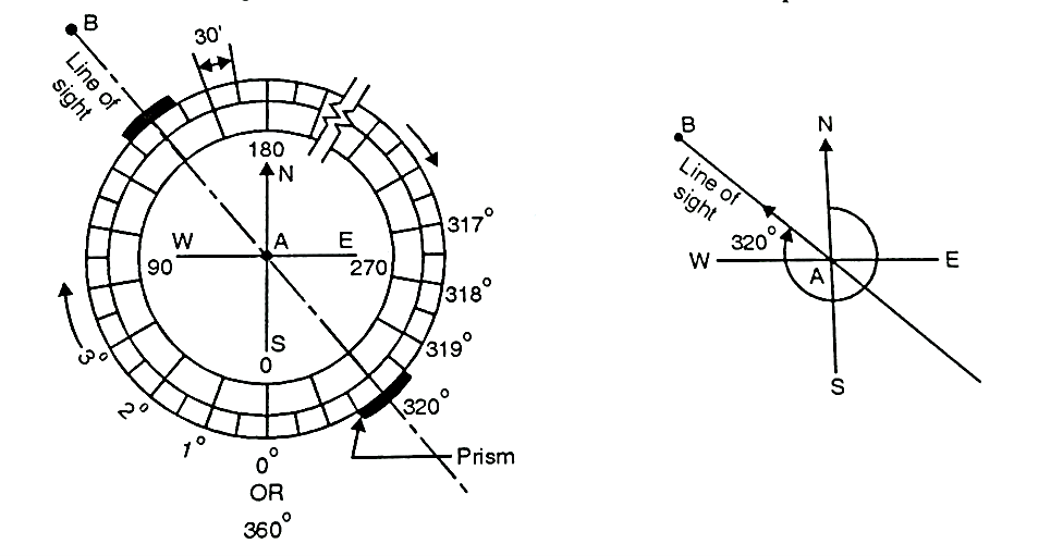
Fig. Graduations in Prismatic Compass
Q6) Explain concept and type of bearing in detail.
A6) The horizontal angle made by a survey line with reference to magnetic north pole in a clockwise direction is called as the bearing of a line.
Types of bearings:
1. Whole circle bearing (W.C.B.) system:


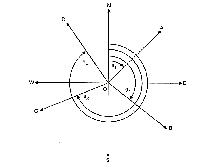
Fig: Whole Circle bearing
2. Reduced bearing (Quadrantal system):
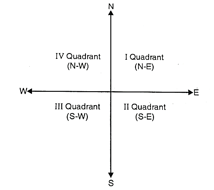
Fig: Quadrantal bearing
Q7) What is meridian and explain the types of meridians.
A7) The reference line with respect to which horizontal angle of survey line is measured, known as meridian.
Types of meridians:
a) True Meridian: The line or length passing through the geometrical north pole, geographical south pole and any point on the earth surface is known as true meridian.
b) Magnetic Meridian: It is the direction indicated by freely suspended and balanced magnetic needle unaffected by local attractive forces. The location of magnetic pole is continuously changes hence, the direction of magnetic also changes.
c) Arbitrary Meridian: It is any convenient direction usually from survey station to some well-defined permanent object. This is used for small area survey or to determine the relative direction of small traverse.
Q8) What do you mean by local attraction and explain concept of local attraction in detail.
A8)
Detection of Local Attraction:
Note: If F.B.-B.B. = 180°; free from local attraction / same local attraction.
If F.B.-B.B. 180°; affected by local attraction.
Effect on included angle:
Adjustment of Local Attraction or Eliminating the Effect of Local Attraction:
There are two methods by which the effect of local attraction can be eliminated or can be adjusted.
Method I:
Method II:
Q9) Explain dip of the needle and declination in detail.
A9)
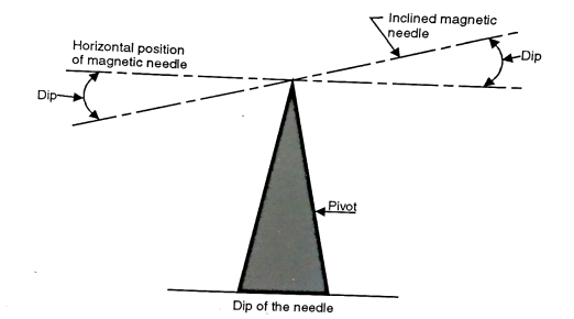
Fig: Dip of the needle
Declination:
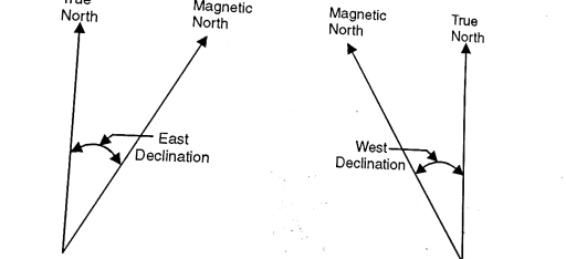
Fig: East and West declination respectively
Determination of Declination:
The methods commonly adopted for determining magnetic declination are:
1. By observation to sun:
2. By isogenic charts:
Q10) What are the equipments required for the plane table surveying.
A10) The accessories of plane table are:
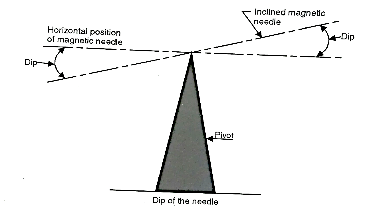
Fig: Trough and Circular Compass
A trough compass or circular box compass:
A plumbing fork or U frame:
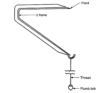
Fig: Plumb bob with U frame
A bubble tube or spirit level:
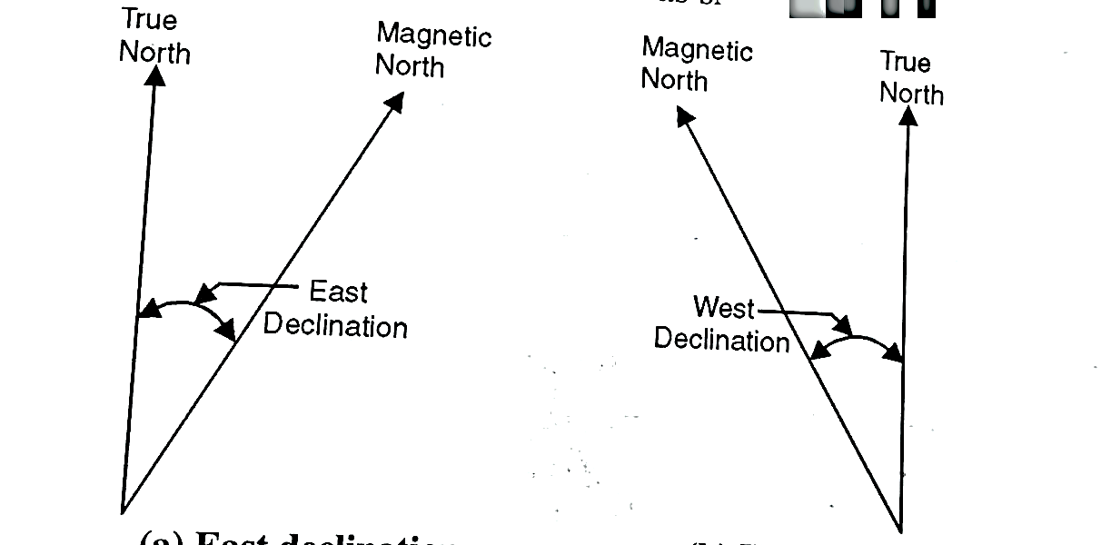
Fig: Spirit level
A water proof cover:
Drawing sheet:
Other drawing materials:
Q11) Explain advantages and disadvantages of plane table surveying.
A11) Advantages:
Disadvantages:
Q12) Explain the errors occurred in plane table surveying.
A12)
1.Instrumental Errors:
2.Error due to Manipulation and Sighting: These includes-
(a) Non-horizontality of board.
(b) Defective sighting.
(c) Defective orientation.
(d) Movement of board between sights.
(e) Defective or inaccurate centering.
(a) Non-horizontality of board:
(b) Defective Orientation:
(c) Defective Orientation:
(d) Movement of board between sights:
(e) Inaccurate Centering:
Q13) Explain the radiation method of plane table surveying.
A13)
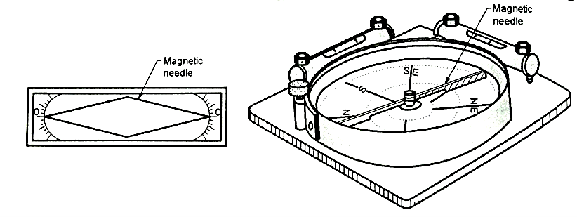
Fig: Resection Method
Procedure:
Use:
Q14) Explain intersection method of plane table surveying.
A14)
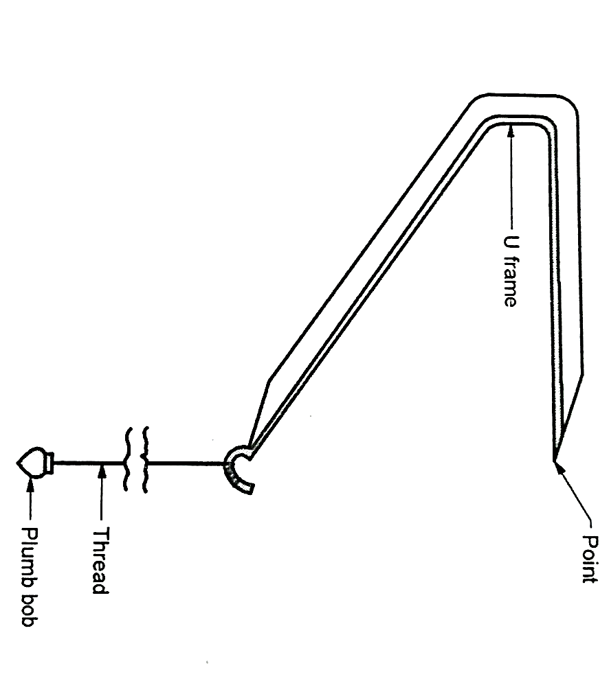
Fig: Intersection method
Procedure:
Use:
The intersection method is used for:
Q15) Explain traversing method in detail.
A15)

Fig: Traversing Method
Procedure:
Uses:
Traversing method is used:
Q16) Explain resection method in detail.
A16)
Procedure:
Q17) What are the types of leveling?
A17) Types of leveling are as follows:
1. Simple leveling:
2. Differential leveling:
3. Fly leveling:
4. Profile leveling:
5. Cross-section leveling:
Q18) Explain the various types of benchmarks in detail.
A18) Types of Benchmark area as follows:
1. G.T.S. bench marks (Great trigonometrical survey bench marks):
2. Permanent bench marks:
3. Arbitrary bench marks:
4. Temporary bench marks:
Q19) What is dumpy level explain in detail with the use of dumpy level.
A19)
a) A tripod stand
b) Levelling Head
c) Telescope
(a) A tripod stand:
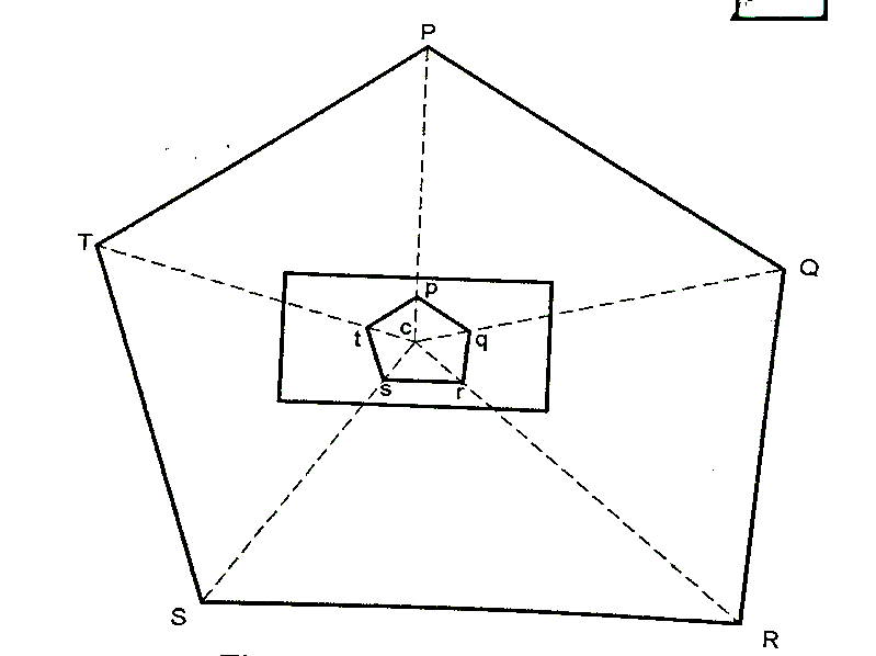
Fig: A tripod stand
(b) Levelling head:
(c) Telescope:
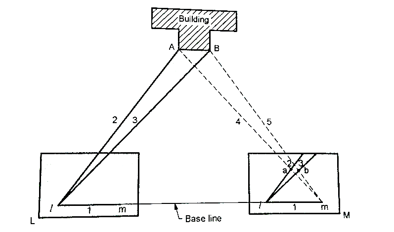
Fig: Dumpy level
Q20) Explain auto level in detail.
A20) These instruments require only approximate levelling by reference to a good circular bubble, and they have no sensitive bubble.
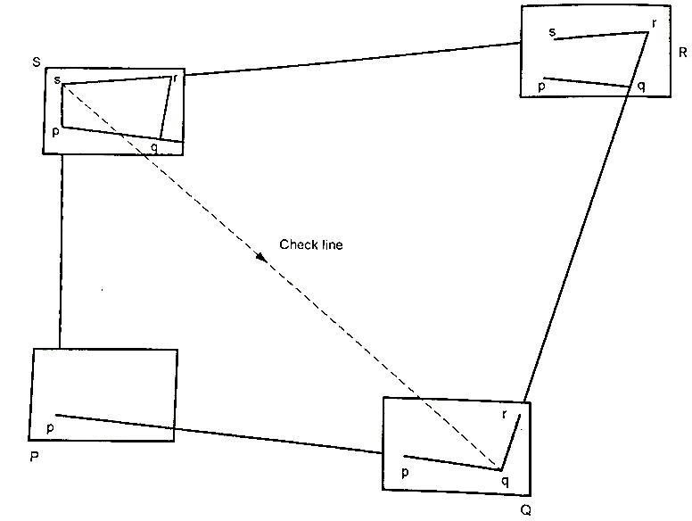
Fig: Auto level
Setting up the Instrument:
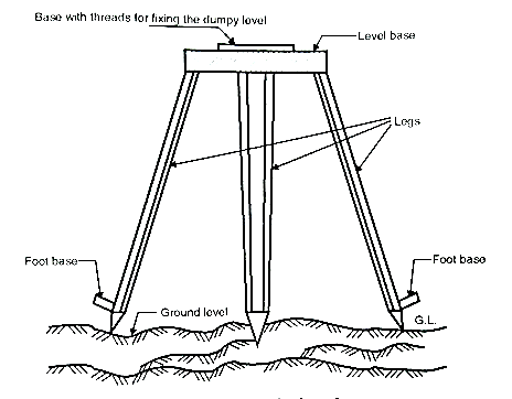
Fig: Auto level
Focussing and Sighting:
Operation:
Measuring height difference:
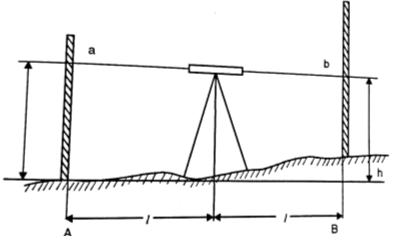
Fig: Set up
Measuring Horizontal Angle: