Unit - 5
Construction survey & Modern Techniques such as Space Based Positioning System (SBPS)
Q1) How to establish horizontal controls?
A1)
When the area is small:
When the area is very large:
When the area is more extensive:
Q2) How to establish vertical control?
A2)
Q3) How we can maintain verticality of tall buildings?
A3)
Q4) Explain Reconnaissance survey?
A4)
Q5) Explain Preliminary survey?
A5)
Objects:
Q6) Explain about location survey?
A6)
Objects:
Q7) Explain setting out of a tunnel?
A7) The survey work of a tunnel involves the following operations:
Locating centre line of the tunnel on ground:
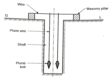
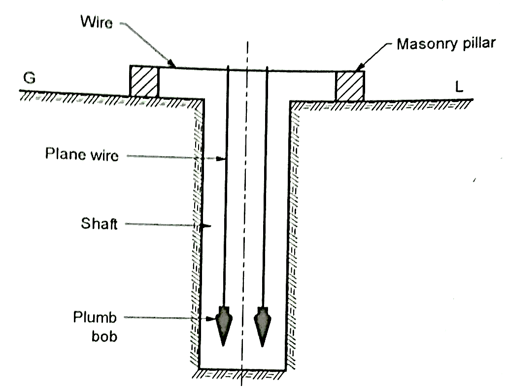
Constructing the shaft over the centre line:
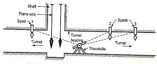
Transferring the alignment to inside of the tunnel:

Fig.: Transferring the alignment at the bottom of the shaft

Fig.: Transferring the alignment to inside of the tunnel
Q8) What is SBPS system?
A8)
Q9) Explain about GPS?
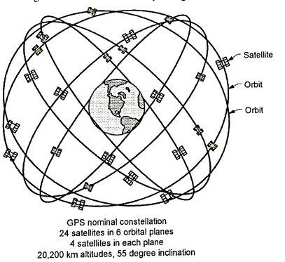
A9) Working System of GPS with SBPS:
Q10) What are the types of GPS?
A10) Types of GPS are as follows:
There are the basic types of survey grade systems in GPS.
Single Frequency:
This type of surveying with a single frequency system is called as 'static mode' GPS surveying.
Dual Frequency:
Dual frequency systems only require post processing when operating in static or fast static.
Q11) Explain about GAGAN?
A11)

Fig.: Configuration of GAGAN Satellite
Q12) Explain Space segment?
A12)

Fig.: Details of Space segment
Q13) Explain Control segment?
A3)
Q14) What is the importance and Role of Space Segment, Control Segment and user Segment in SBPS?
A14) Space segment
Control segment
User’s segment
Q15) Explain application of SBPS in surveying?
A15)